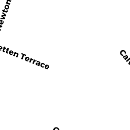
169 NEWTON ST
Owner Information
TORRES, LAZARO
169 NEWTON ST.
WALTHAM, MA 02453


Property Details
169 NEWTON ST is classified as a Single Family Residential (Colonial).
The primary structure on this property was built in 1900. There are 1,426ft2 of built area within this property. There is 1,426ft2 of residential/living space within this property. This property is listed as having 6 rooms.
169 NEWTON ST is valued at $530,700. The land is valued at $282,800 and the structures are valued at $247,900.
The most recent deed for 169 NEWTON ST is recorded at the local registrar in Book 60421, Page 207. 169 NEWTON ST was last sold on Monday, November 5, 2012 for $330,639.
Assessment data from fiscal year 2022.
Flood Data
According to the FEMA National Flood Hazard Layer, this property does not appear to be in a flood zone. It may also be in an area not yet reviewed. Nonetheless, confirm this information prior to taking any action.
To view the flood hazards around this property, create a FEMA "Firmette" Map of the area around 169 NEWTON ST.
Broadband Internet Providers
| Provider | Type | Bandwidth (mbps) | |
|---|---|---|---|
| VSAT Systems, LLC. | Satellite | 2 | 1 |
| Verizon New England Inc. | DSL | 10 | 1 |
| Verizon New England Inc. | Fiber | 940 | 880 |
| Comcast | Cable | 1000 | 35 |
| RCN | Cable | 500 | 20 |
| RCN | Cable | 1000 | 20 |
| HughesNet | Satellite | 25 | 3 |
| GCI Communication Corp. | Satellite | 0 | 0 |
| Viasat Inc | Satellite | 100 | 3 |
Broadband service provider data from December 2020.
Adjacent Properties
- 12 -14 MCKENN ST
Mixed Use (Primarily Residential, some Commercial) owned by FERRE, ROBERT E. & MARIA G. - 173 -1 NEWTON ST
Residential Condominium owned by BERISHA, GENE & EMIRA AJETI - 173 -2 NEWTON ST
Residential Condominium owned by MACNEILL, KARA M. - 173 -4 NEWTON ST
Residential Condominium owned by POTDAR, SHOBHANA & PRIYANKA - 173 -3 NEWTON ST
Residential Condominium owned by KINCEL, JOSEPH MARTIN - 163 -67 NEWTON ST
Apartments with Four to Eight Units owned by FERRE REALTY TRUST; - 177 NEWTON ST
Multiple Houses on one parcel owned by MARTOCCHIA, ANDREA &